It's a Dirty Business

Watch Channel 4's documentary about the state of the water industry, then sign the petition to bring water back to public ownership.

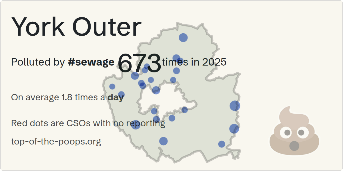
York Outer - Live Sewage

Polluted by sewage 3,727 hours in 2026 , monitoring offline 19,309 hours , potential overflows 6,295 hours so far..

© OpenStreetMap contributors
Contains OS Data © Crown copyright & database right 2021-2024
© Top of the Poops 2021-2024

Which Year?

Select Another Constituency

Select the constituency from the drop-down
✔ means we have live data (𝑥 if not)

View Annual Sewage Data

You're looking at the totals that we have calculated for sewage in York Outer so far for 2026. It is an estimate, based on very poor quality live data from the Water Companies. The water companies report their sewage to the Environment Agency every year in April. You can see the last reported year in the other page

What's a potential overflow? If the CSO goes 'Offline' while its Overflowing, we don't know if it stopped overflowing until we get a 'Stop' event.

Take Action

Your local MP is Luke Charters (Labour) - Find out more about their interests, donors, and voting at They Work For You
Share this page, post a message, and tell others about the huge problem of sewage pollution across the UK

Daily Data

Jan - 1,157 hours , 744 potential
Feb - 1,499 hours , 672 potential
Mar - 43 hours , 744 potential
Apr - 2 hours , 720 potential
May - 50 hours , 744 potential
Jun - 0 hours , 720 potential
Jul - 0 hours , 744 potential
Aug - 72 hours , 744 potential
Sept - 429 hours , 302 potential
Oct - 472 hours , 159 potential
We need your support!

Please consider a one-off or small recurring donation. We need your help to keep this site going.

Donate Now

Totals so far

Company Site Name Receiving Waterway Overflow Days Total Duration (hours) Offline/Potential Pollution
Yorkshire Water KEXBY/STW River Derwent 55 976h 9m -
Yorkshire Water BRECKSFIELD/NO 2 CSO Burtree Dam 41 844h 39m 6,294 h
Yorkshire Water ELVINGTON BECK/CSO Elvington Beck 38 601h 4m -
Yorkshire Water NABURN YORK ROAD/CSO River Ouse 21 369h 29m -
Yorkshire Water RIVERSIDE GARDENS/CSO River Ouse 47 297h 31m -
Yorkshire Water ASKHAM BRYAN/STW Foss Dike 37 282h 30m -
Yorkshire Water RAWCLIFFE YORK/STW River Ouse/Rawcliffe Ings Dr 20 124h 59m 0 h
Yorkshire Water HAXBY STORM TANKS/STW River Foss 11 58h 42m -
Yorkshire Water COURTNEYS/CSO Ditch 9 50h 5m -
Yorkshire Water RUFFORTH/STW Smawith Dike 4 26h 56m 0 h
Yorkshire Water EARSWICK WILLOW GROVE/CSO River Foss 4 23h 37m 9 h
Yorkshire Water MILL HILL/CSO River Foss 6 18h 25m -
Yorkshire Water FULFORD MAIN STREET/CSO Germany Beck 16 13h 26m -
Yorkshire Water MILLFIELD LANE YORK/CSO River Ouse 8 9h 56m 0 h
Yorkshire Water STRENSALL/CSO River Foss 13 9h 31m 1 h
Yorkshire Water LOWER POPPLETON/CSO River Ouse 4 5h 53m 0 h
Yorkshire Water MAYFIELD GROVE/CSO Holgate Beck 5 4h 50m -
Yorkshire Water SKELTON FAIRFIELD/CSO Unknown Beck 4 4h 7m -
Yorkshire Water HESLINGTON MAIN ST/CSO Germany Beck 2 2h 54m -
Yorkshire Water CLIFTON HOSPITAL/CSO River Ouse 1 1h 26m 6,062 h
Yorkshire Water MEADOW FIELD/CSO River Foss 1 1h 14m -
Yorkshire Water ASHLEY PARK CRESCENT/CSO Tang Hall Beck 1 0h 22m -
Yorkshire Water COPMANTHORPE/CSO Town Ings Drain 0 0h 6,617 h
Yorkshire Water SHIPTON ROAD/NO 2 CSO Blue Beck, Ouse 0 0h -
Yorkshire Water NORTH LANE/SPS Holgate Beck 0 0h 6,617 h
Yorkshire Water HESSAY MAIN STREET/CSO New Dike 0 0h -

Data Sources & Accuracy

EDM (Event Duration Monitoring) data and Consented Discharges to Controlled Waters with Conditions from Environment Agency & Data Map Wales, and Scottish Water

Experimental derived data from Thames Water API, Some data may be missing or inaccurate. Live sewage data from Stream Water API

Annual figures up to and including 2025 come from official water company returns. The 2026 figure is our own estimate, derived continuously from the companies' live data feeds.

Uses Environment Agency rainfall data from the real-time data API (Beta) - Rainfall data is delayed by up to two days.

This website is intended to provide an accurate representation of the Environment Agency data. The data is hard to use, and thus some errors may have been made. If you find something that is incorrect, please raise an issue at the GitHub issues page and we'll endeavour to fix it quickly.

This project is not associated, approved or endorsed by any of the companies whose logos you see here.